Excited for what’s to come. I am even more excited to share my story and adventures with all of you.
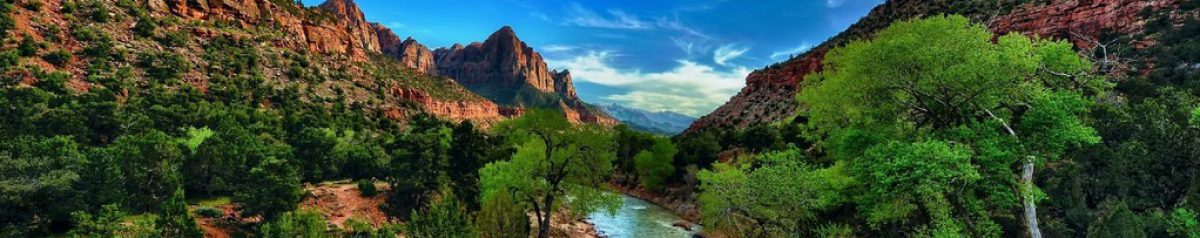
New Zealand
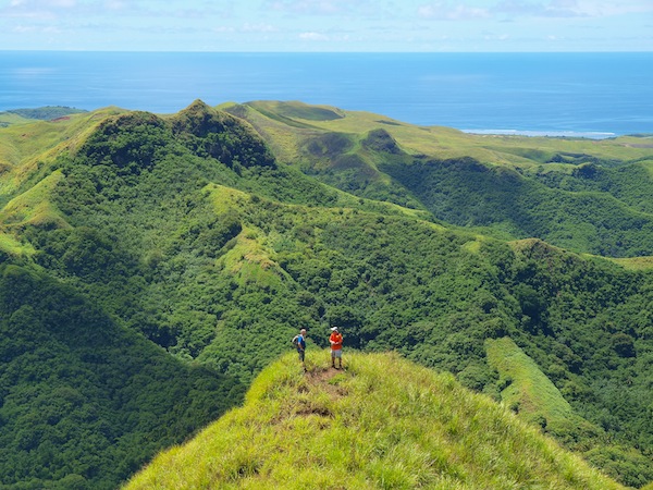
New Zealand is an island nation located near the center of the water hemisphere. It is located approximately 1,350 miles (2150KM) from Sydney Australia, and about 1,500 miles (2,400KM) North of Antarctica (however the closest airport in Antarctica is about 3,000 miles (4,800KM) from New Zealand. The island nation is made up of two main islands, the North Island and the South Island, along with about 500 smaller islands under the territory control of the country. New Zealand was one of the last countries on the planet to be inhabited by humans due to its unique geographical location. There are 14 National Parks in this country, which attracts millions of tourists every year, along with film makers, photographers, etc. Many famous movie / television series have been filmed in New Zealand including the famous Lord of the Rings trilogy and The Hobbit. Many people have the false assumption that New Zealand is a tropical island country within the Pacific Ocean, however this is not exactly true. Although in the Northern Island, temperatures can easily reach beyond 100 Degrees Fahrenheit and is considered a tropical region, the Southern Island is relatively close to the southern arctic circle and can reach temperatures below 15 degrees Fahrenheit while receiving annual snowfalls exceeding 5 ft. I the inland higher altitude areas. With over 20% of the country covered in National Parks, the unique wildlife the country has to offer, and the secluded area that could get me to escape from everything, New Zealand is where I currently wish I was right now instead of working 45 stories up in the concrete jungle of NYC.
 What to do: New Zealand has many famous attractions that attracts many people from all over the globe every year. Famous for Sky-Diving, Bungee Jumping in Queenstown, climbing glaciers, and going Zorbing (a giant plastic ball that you run down a mountain inside of), are just a few recreational activities that you can do! The Bay of Islands is something that is definitely unique and a MUST DO! Here, grab a kayak, put on your swim suit, and go out for the day. Here you will be able to go snorkeling, lay out on the beach, and even swim with dolphins! Take a cruise through the famous Milford Sound, which is absolutely stunning and considered to be the 8th wonder of the world. You can also hike the Tongariro Crossing, which is considered by many to be one of the best day hikes in the entire world. This hike will take you up through huge valleys, up mountain slopes and to incredible volcanic lakes. This is also where you will find Mount Doom from The Lord of the Rings! Aside from all of this, there is also whitewater rafting through class 5 rapids, backpacking opportunities, sailing, seeing the famous glowworms within the caves of New Zealand, seeing the infamous Moeraki boulders, visiting ancient villiages, and finally going to Wai-O-Tapu which is a majestic day trip and a MUST DO!
 My Recommendation: If you are like myself and plan on traveling the globe for an extended period of time, I would spend 2 weeks on the Northern Island and 2 weeks on the Southern Island, then move on to my next destination. A lot of people think that you should only spend 1 week on each island, however due to the infamous National Parks, scenic views, and vast opportunities to have the experience of a lifetime, I would not cut this trip short. I would spend 1 week on each island visiting National Parks, backpacking, hiking, exploring, etc. I would spend the other week visiting the cities, local towns, relaxing on the beaches, and exploring the culture the island has to offer within its community.

HOWEVER, if you are only planning on coming to New Zealand for a 2-week Vacation, your plans may change. Spend 1 week on each Island to start. Spend at least 3 days exploring National Parks / nature on each island. Then I would pick out 1 day on each Island for major activities such as white water rafting, bungee jumping, Zorbing, & other local activities. Then spend the other 2 days relaxing and doing whatever is you want, after all it is your vacation! (I did not forget about the other 2 days… 1 day for arriving, and 1 day for leaving… )

Thank you for reading. Please like, share and subscribe for more daily places in the world that I am currently dreaming of being at rather than work.
Please Note: I do not advertise for any of the mentioned companies or locations in which I advertise for. I do this 100% for fun and for other want-to-be travelers who want to read.
The Tiny Pacific Island of Guam
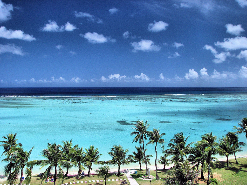
Today I wish I was on my way over to the Asia-Pacific region of our planet.. and along the way I would be making a pit stop at Guam! I am thankfully working from home today, but it is pouring rain, and this business call is stressful.. so Guam is sounding pretty good right now! Guam is a tiny island located North-West of New Zealand, and can be accessed by air travel, cruise travel, or by cargo (if you are feeling adventurous and on a budget). Guam is the closest land mass to the Mariana Trench (deepest point of the Ocean in the world), and is almost completely surrounded by Cora; table reef. The island is approximately 212 square miles in size, 30 miles long and between 4-12 miles wide. The highest point in Guam is Mount Lamlam at about 1,300 Ft (400m) in elevation. Guam’s population is over 50% military personnel or people who are related to the military personnel stationed on the island. The main source of the economy is tourism, so there is plenty to do while you are here! Guam has many connecting flights coming in from the United States and the Eastern Asia Pacific region. This can be used to essentially travel to Guam for free on your way to say The Philippines. Many travel agencies allow you to use Guam as a layover, and you can stay for a few days before the connecting flight is actually planned! This is why I am planning on visiting Guam regardless of any other travel plans I have for this region of the world.
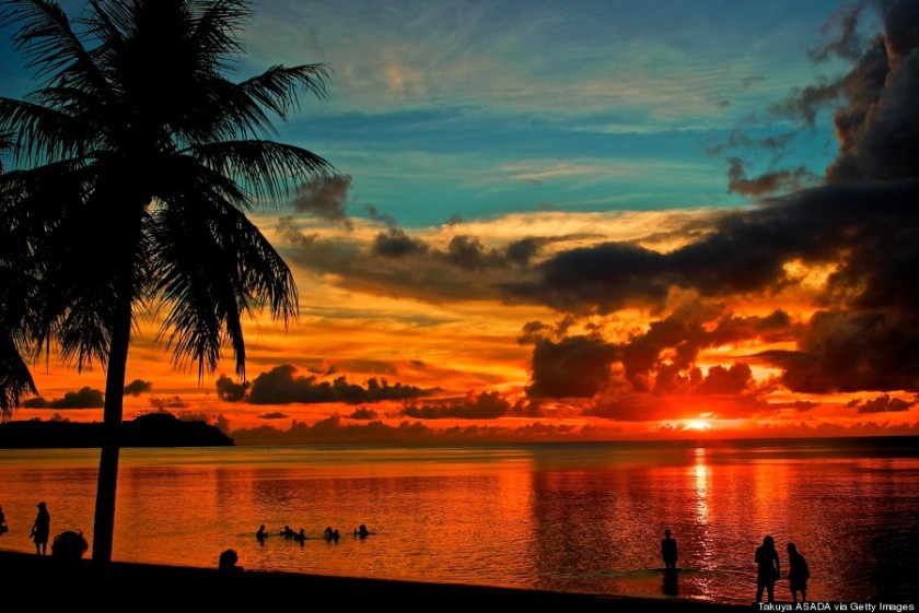
What to do here: One of the most popular attractions on the island is snorkeling and scuba diving. Guam is almost 100% surrounded by a tropical table reef that are home to thousands of species of plants, sponges, plants and more! Guam rarely experiences rough waters, due to its geographical location, making this divers paradise. The island also offers deeper barrier reefs that are only a 10-20 minute boat ride away from Guam’s shores. The water temperature is around low-mid 80’s (Fahrenheit) year round, making the perfect conditions for diving. Another main feature of the island is the hiking. Many people would not consider Guam a destination to go hiking, but the locals will tell you different. Hiking in Guam can be extremely rewarding, as the hikes are short (all within a days length), and have many hidden secrets including waterfalls, hidden coves, wildlife and more. In addition to diving and hiking, one can experience exotic food at restaurants, you can explore ship wrecks from WWII, and relax on the beautiful beaches on a tropical resort. 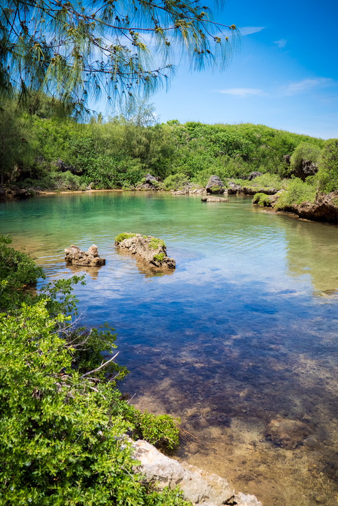
Did I forget to mention that you can climb the tallest mountain on the planet in Guam?? Mount Lamlam, although sitting only 1,300 ft (400m) in height on the island, is considered the tallest mountain on Planet Earth. Why is this? Mount Lamlam is apart of the Mariana Trench, which technically makes this a mountain apart of the Mariana Trench. With the Mariana Trench elevation included, the mountain is approximately 37,500FT (11,400M), in elevation. In comparison, Mount Everest is 29,040 feet (8,800M) in elevation.
My Recommendation: If I was traveling to Guam, I would use it as a layover trip on my way over to Asia. I would spend no more then 3 days on this tiny island (more then enough time). My very first day would be spent sleeping and relaxing on the beach with a nice drink in my hand. This is highly recommended considering you just got off a 18 hour flight. The next day would be spend Scuba Diving and Snorkeling while trying out some exotic food that is distinct to the island of Guam. The last day would be spent hiking and covering as much of the island as I possibly could in a single day. This is also recommended so that you would be completely exhausted and enjoy a nice flight asleep. 
Thank you for reading. Please like, share and subscribe for more daily places in the world that I am currently dreaming of being at rather than work.
Please Note: I do not advertise for any of the mentioned companies or locations in which I advertise for. I do this 100% for fun and for other want-to-be travelers who want to read.
Olympic National Park
Yesterday I had a nice, well-earned day off in which I spent golfing with my brother. It was a beautiful day out and I feel well-rested. With this considered, I am back at work today and continue to wish I was out somewhere in the world. In continuation with my thoughts in moving to Seattle, Washington for a year to explore the local National Parks and state forests (Canada & US), today I will cover Olympic National Park.
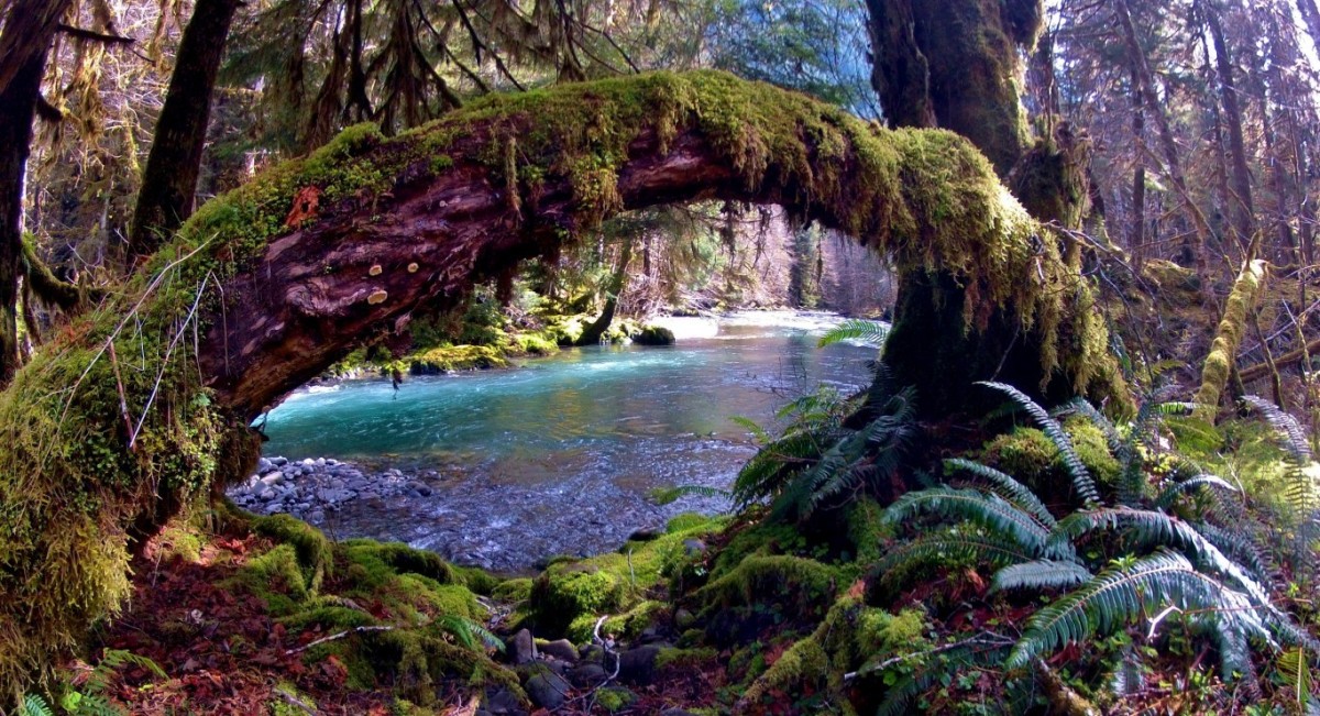
Olympic National Park is located on the Olympic Peninsula, directly west of Seattle, Washington. The park has 4 regions: The pacific coastline, the alpine areas, the western temperate rainforest, and the drier forests on the eastern side. The park is 922,651 acres in size (95% is national park, 5% state park), has 73 miles of wilderness coastline, 3,000 miles of rivers and streams, 60 glaciers, and multiple mountain peaks. Olympic National park has over 3 million yearly visitors, making it one of the most popular National Parks in the country. There are 16 campgrounds, 64 trailheads and over 600 miles of trails. This park is approximately a 2 hour drive to the South-East side of the park, and can take an extra 30-45 minutes to reach the North-Eastern areas of the park, from central Seattle. Visitors can easily make a day trip or even a weekend trip out if they live in / nearby Seattle which is one of a few reasons why I want to move to Seattle for a year. 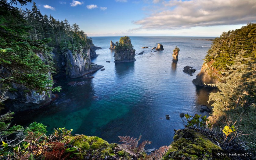
Climate: The climate in this region is diversified due to the sheer size and geography of the park… Therefor I am just going to cover the general specs.. Please check your local weather before heading into the park AND YES YOU MUST CHECK THE WEATHER! The climate in the Seattle area is pretty consistent year round. Due to its unique geographical location with the weather streams, extreme heat waves are rare as well as very cold temperatures. During winter months, temperature averages from 36-45 degrees Fahrenheit, and during the summer month’s temperatures average from 56-76 degrees. However, this weather can completely change once you head inside the National Park. Once you begin gaining elevation in the National Park, temperatures begin to change. The average during the summer months is in the range of 42-63 degrees Fahrenheit (6-17 Celsius) but can reach into the 90’s(F) at some points. The average during the winter months ranges from around 20-34 degrees Fahrenheit (-5-1.5 Celsius) and can hit extreme lows into the teens (-15F for example). 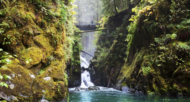
When to visit: Although the park is open year round, the Summer is the dry season. Compared to the other location National Parks in the region (Mt. Rainier and Northern Cascades), this National Park can be hiked / traveled for more months out of the year due to its geographical location near the Pacific. Making for less snowfall, the trails are much less dangerous and open. Expect cool temperatures, rain and fog at any point throughout the year as this is considered a rain-forest. 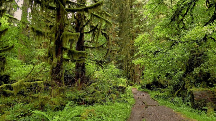
How to get there: Take US 101 west, which will pass by 3 different sides of the park. The main visitor center and entrance are in Port Angeles. The United States of America has almost all of its roads / and all of its highways mapped out through GPS. It is extremely easy to plug in a location or address through GPS to find your best route based off of your current location. 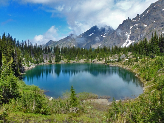
Wildlife: There is a huge diversity in Olympic National Park due to its geographical location. There are 20 reptile and amphibian species, 37 native fish species, 300+ bird species, and 56 different mammals, including 24 marine mammal species. At least 16 of these species are considered endemic (only in one geographical location… I learned this word todayJ). Animals that are common in this park are chipmunks, squirrels, skunks, 6 species of bats, weasels, coyotes, muskrats, river otters, beavers, red fox, mountain goats (accidentally introduced and being controlled), martens, bobcats, black bear, moles, shrews, whales, dolphins, sea lions, seals and sea otters. Uncommonly spotted in the park are Canadian Lynxes, and cougars (mountain lions). Bird species include wrens, gray jays, flycatchers, raptors, warblers, grouses, siskins, ravens, spotted owls, nuthatches, kinglets, red crossbills, thrushes, bald eagles, western tanagers, pygmy owls, Vaux swifts, pigeons, grosbeaks, and many many more. 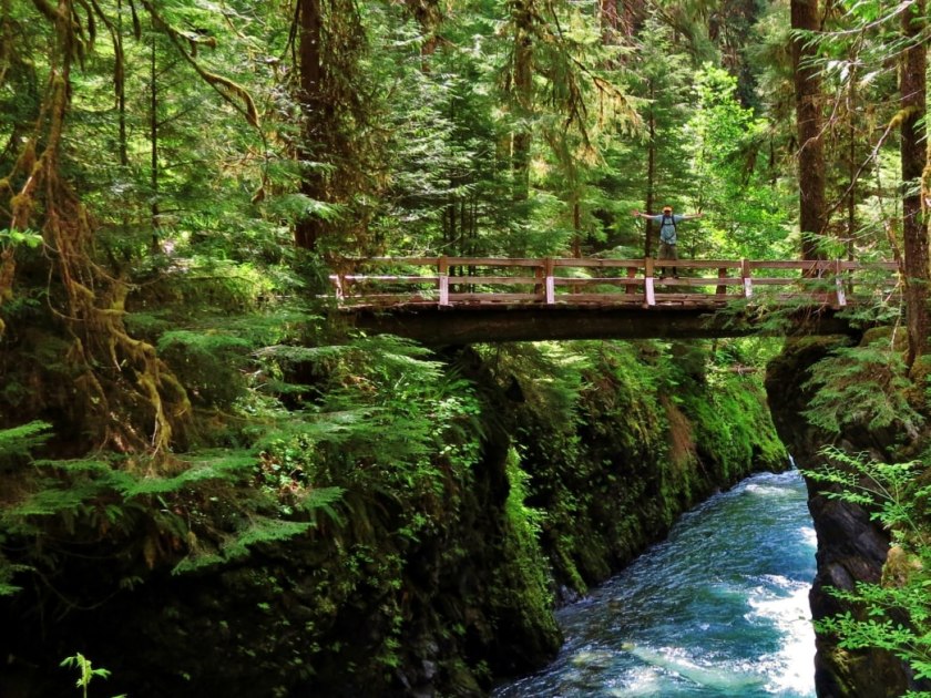
What to do here: Boating, fishing & hiking is what brings the majority of people to this park. Other activities include tidepooling because of the vast length of shorelines and wildlife diversity, camping, backpacking, wildlife viewing tours (you have a good chance of seeing wildlife on your own if you research beforehand), ranger tours as well as night sky tours are also very popular. If you are in the area during the winter, there is a pretty awesome ski slope that exists within the national park as a more natural ski slope.
Climbling Mount Olympus: It is highly recommended that only skilled mountain climbers attempt this challenge. Due to Mount Olympics rocks being composed of shale, sandstone, and basalt, the mountain is extremely fragmented, choosy and loose. Unlike the solid granite in the Cascades and Mount Rainier, Mount Olympus guarantees that at some point you will have a few showers of loose rock falling towards your head (helmet is required). Climbers on this challenge often find unstable snow, fractured rocks, hurricane-force winds, and rapidly changing weather. Cell phone coverage is rare and help is far away. Make sure you do your research ahead of time and plan plan plan. This may save your life before the climb even begins.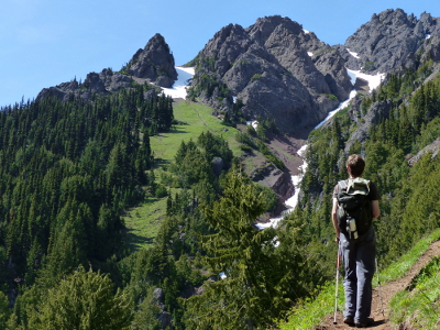
My recommendation: As mentioned before, the park has 4 regions: The pacific coastline, the alpine areas, the western temperate rainforest, and the drier forests on the eastern side. I would recommend spending 1 day in each region to gain the most out of this National Park. Spend the trip camping out in the night stars to get the most definitive experience (after all you are visiting a National Park). I would recommend backpacking in North Cascades National Park instead of here due to the extreme weather and geographical location. Backpacking here could get a little wet, and for the same reason I would only stay at one of the 16 campsites or within a camper. Make sure to bring campfire snacks / food and plenty of beer for the cold nights.
If anyone has ever been to Seattle or lives(d) in Seattle, please leave any tips or information!
Thank you for reading. Please like, share and subscribe for more daily places in the world that I am currently dreaming of being at rather than work.
Please Note: I do not advertise for any of the mentioned companies or locations in which I advertise for. I do this 100% for fun and for other want-to-be travelers who want to read.
North Cascades National Park
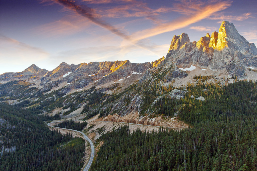
Today I wish I was hiking or on a backpacking adventure in North Cascades National Park. North Cascades National Park is located in Washington State, about 2 hours 30 minutes driving from central Seattle. North Cascades is just over 500,000 acres of reserved land, doubling the size of Mount Rainier National Park. The park is separated into two main regions: The Northern district and the Southern district. The Northern district goes up all the way to the Canadian border. North Cascades National park is apart of the Cascades Mountain region and is the largest park in the area. There are over 500 lakes / ponds and over 300 glaciers, which is the most in the entire United States mainland 48 states. This park consists of many extreme peaks that top off at over 8,000 Ft. Out of the entire Cascade mountain region, North Cascade has the steepest mountains. There are over 400 miles of hiking trails throughout this park as this was one of the main traveling routes for Native Americans and for Western Settlers back in the day. Last night I was stuck working until 8pm, followed by a 2 hour commute home.. when I began my day at 6am… only being paid for 8 hours… I am definitely counting the days before I begin traveling the world..
Climate: The climate in this region is diversified due to the shier size and geography of the park… Therefor I am just going to cover the general specs.. please check your local weather before heading into the park AND YES YOU MUST CHECK THE WEATHER! The climate in the Seattle area is pretty consistent year round. Due to its unique geographical location with the weather streams, extreme heat waves are rare as well as very cold temperatures. During winter months, temperature averages from 36-45 degrees Fahrenheit, and during the summer month’s temperatures average from 56-76 degrees. However, this weather can completely change once you head inside the National Park. Once you begin gaining elevation in the National Park, temperatures begin to change. The average during the summer months is in the range of 42-63 degrees Fahrenheit (6-17 Celsius) but can reach into the 90’s(F) at some points. The average during the winter months ranges from around 20-34 degrees Fahrenheit (-5-1.5 Celsius) and can hit extreme lows into the teens (-15F for example).
When to Visit: Low elevation trails are most visited between April and October, with the driest weather from mid-June to September. Visitation to the highcountry (above 5,000 feet/ 1524 m) is greatest after the snows melt, generally from July through early October. The best snow mountaineering conditions are often June and July. The park is open year round, but heavy winter precipitation limits road access and increases backcountry hazards between November and March. 
Wildlife: Wilderness of the North Cascades hosts wildlife less common in the more populated areas of Washington State. 75 mammal species in 21 families can be found in the North Cascades. Three species (gray wolf, grizzly bear, and Canada lynx) are listed as “threatened” or “endangered” under the Endangered Species Act. Other species include black bear, wolverine, river otter, cougar, lynx, and bobcat, mule deer, marmots, pikas, and occasionally elk, moose and mountain goats. There are over 500 species of birds for bird watching fanatics. Some popular birds that can be found here are bald eagle, osprey, Harlequin duck, golden eagles, and more. In addition, 21 species of reptiles reside here, at least 28 species of fish, and over 500 types of land insects, including butterflies, dragonflies, stoneflies, and mayflies (the most of any National Park).
What to do here: North Cascades National Park is an extremely popular destination for backpackers. With over 400 Miles of hiking trails, one can easily get lost in the beauty and challenges that this park has to offer. There are hundreds of trails for people who want to come for either a day hike and head out, or for individuals who just want to spend a few days visiting the park and want to hit different day trails in different sections of the park. The majority of the day hiking trails are located off of the Northern Cascades Scenic Highway, where there are easy access trail starts. Also check out Cascade River Road, Baker Lake Road and Mount Baker Highway areas, which also have many great day hikes. One of the more famous trails is the Hidden Lake Trail which offers more scenic views per trail compared to all other trails within the park. If you’re looking into backpacking, check out the Stehekin region. Stehekin is translated into “The way through” by local Native Americans. This is the region and trail set that settlers and Native Americans used to travel by and would be pretty neat to experience some history while backpacking. This region is also where McGregor Mountain (and trail) are located. This is the most popular Mountain trail in the park and is over 15miles round trip with an elevation gain of 6,400 Ft (1920M).

My recommendation: If I was in the area for a short period of time, and was planning on visiting all 3 local National Parks, I would utilize this park as a backpacking opportunity. I would hike through the Stehikin region for approximately 3-4 days while setting up my own campsite or staying in my van. If you are coming with family and backpacking is not something you are interested in, I would recommend visiting this park for at least 4 days due to its shier size. 2 days in the Northern region and 2 days in the Southern Region. Although the Southern region is more popular, I always find that the less explored sections of the park have the most to offer. Take advantage of the day hiking trails and remember to camp out under the stars and enjoy some beer and campfire activities (your kids will thank you when they’re older). Personally when I am in this area, if I am living in Seattle for a year as I am thinking of doing, I am going to take multiple 3 day weekends to attempt some of the backpacking opportunities as well as some of the day hikes. If I am passing through this park with my van, I am planning on spending 1 full week in the Southern region, and one full week in the Northern region while backpacking for 4 days in each and spending the other 3 doing day hikes.


If anyone has ever been to Seattle or lives(d) in Seattle, please leave any tips or information!
Thank you for reading. Please like, share and subscribe for more daily places in the world that I am currently dreaming of being at rather than work.
Please Note: I do not advertise for any of the mentioned companies or locations in which I advertise for. I do this 100% for fun and for other want-to-be travelers who want to read
Mount Rainier National Park, Washington

Today I wish I hiking Mount Rainier insteas of being stuck 45 floors up in the finacial district of NYC.
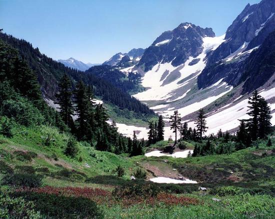
Mount Rainier National park is located about 50 miles South-East of Seattle, Washington. It is located on the most North-Western corner of the United States on the Pacific Ocean, excluding Alaska. Mount Rainier is the 5th oldest National Park in the United States of America. The park is over 225,000 acres large and includes the monstrous 14,411 foot (4,392M) active Mount Rainier Volcano, in which the park is named after. Within the National park there are valleys, waterfalls, meadows, old-growth forests, and more than 25 glaciers (including the largest in the United States outside of Alaska). As I went over yesterday, I am debating with myself on moving to Seattle for a year before I start my world-travel business. While I am in Seattle, I will definitely be exploring Mount Rainier National Park on multiple occasions.

The climate in the Seattle area is pretty consistent year round. Due to its unique geographical location with the weather streams, extreme heat waves are rare as well as very cold temperatures. During winter months, temperature averages from 36-45 degrees Fahrenheit, and during the summer month’s temperatures average from 56-76 degrees. However, this weather can completely change once you head inside the National Park. Once you begin gaining elevation in the National Park, temperatures begin to change. The average during the summer months is in the range of 42-63 degrees Fahrenheit (6-17 Celsius) but can reach into the 90’s(F) at some points. The average during the winter months ranges from around 20-34 degrees Fahrenheit (-5-1.5 Celsius) and can hit extreme lows into the teens (-15F for example).

How to get there: Depending on which part of the park you want to explore that day, your entrance and your route will change. The two main roads that get you to the park from Seattle are route 165 (North-west entrance) and route 7 (turns into 706) coming into the South-west entrance. They take about the same time to get to. There are roads that travel through the central parts of the park, however do realize that it is still a national park, and you must park then hike to get to most sections worth exploring. Please use GPS to navigate based off of your preference.. The United States has almost all roads in the country mapped out at this point.. Use it to your advantage.
Wildlife: Mammals that inhabit this national park are especially the cougar (mountain lion), black bear, raccoon, coyote, bobcat, snowshoe hare, weasel, mole, beaver, red fox, porcupine, skunk, marmot, deer, marten, shrew, pica, elk, and mountain goat. The mountain goat is one of the iconic animals in this park and are only commonly found when you travel above 2,000 Ft. in elevation and is most commonly found above 5,000Ft. in elevation. Refer to here for more information on where to see mountain goats in Mount Rainier. The common birds of this park including raptors are the thrush, chickadee, kinglet, northern goshawk, willow flycatcher, spotted owl, steller’s jay, Clark’s nutcracker, bald eagle, ptarmigan, harlequin duck, grouse, peregrine falcon, gray jay, golden eagle, grosbeak and finch. Bird watching for large birds-of-prey can be very rich and rewarding if you plan your trip for the Spring – early Summer months.

What to do while here: What brings the majority of people to this park every year is mainly hiking, site seeing, photography, snow skiing in the winter, bird watching, and climbing the Mount Rainier Volcano itself. There are hundreds of hiking trails all throughout the park. Paradise is the most popular destination in the park. There is a historic Inn located in this region of the park as well as dozens of famous hiking trails including the Skyline trail. Paradise is known as the snowiest place on Earth, reaching over 1,000 inches annually. Longmire is another popular destination in the park due to having 178 total campsites throughout the area as well as having its own visitor center. This is the main starting points for many people as well as the famous Wonderland hiking trail. For more hiking try heading over to the Sunrise area of Mount Rainier National Park. From here you hike the Mount Fremont, Burroughs Mountain and Sourdough Ridge trails, as well as visit some iconic meadows in the Springtime, and get to view the Emmons Glacier. For snow skiing in this area, the Mount Baker Ski Area is where I was told everybody goes near Mount Rainier National Park due to its insane annual snowfall of over 1,000 inches. (closest ski resort to Mount Rainier).

Hiking the Mount Rainier Volcano: Over 10,000 attempts are made to hike / climb to the top of Mount Rainier every year. There is only a 50% success rate of actually reaching the peak who individuals who attempt the climb. Most of the lack of success is due to weather patterns as well as lack of physical condition for underestimating the climb. The hike will take approximately 2-3 days to reach the peak depending on how fast you can climb. There are campgrounds located throughout the climb and if you pass the high camps, they require you to purchase a climbing pass and register (mainly to keep track of individuals who may not make it back). FYI Climbing teams require experience in glacier travel, self-rescue, and wilderness travel so DO NOT under-estimate this climb.

Recommendations: For all smaller sized National Parks (Under 250,000 acres) I recommend 4 days and 3 nights while staying within the park at either a local campground or on your own via tent or camper if allowed by the park. 1 night in this park must 100% be spent climbing to Camp Muir. This is the highest non-technical point (10,080FT) in the state of Washington and most of the United States. This hike is over 8 miles round trip, and includes 4,660ft. of elevation and has the most rewarding of views. The next two days I would spend exploring Paradise as well as the Sunrise regions of the park. My recommendation is to stay within Longmire region and maybe start with a warm-up hike every morning as this is one of the easier hiking areas. Spend the nights enjoying the night-skies and having campfires while drinking beer; after all isn’t this why you came here?! Spend the 4th day filling your time with anything you and your accompanied persons want to do.
If anyone has ever been to Seattle or lives(d) in Seattle, please leave any tips or information!
Thank you for reading. Please like, share and subscribe for more daily places in the world that I am currently dreaming of being at rather than work.
Please Note: I do not advertise for any of the mentioned companies or locations in which I advertise for. I do this 100% for fun and for other want-to-be travelers who want to read.
Why I am considering moving to Seattle, Washington
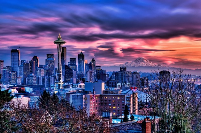
Seattle, Washington is located on the most North-Western corner of the United States on the Pacific Ocean, excluding Alaska. Right now I wish I was working here as opposed to the concrete jungle that is NYC. Seattle is a beautiful city surrounded by water, mountains, evergreen forests, contains thousands of acres of parkland, within an hour drive of three national parks, and over 10 national parks (Canada and U.S.) within a day’s drive.

The climate in Seattle is pretty consistent year round. Due to its unique geographical location with the weather streams, extreme heat waves are rare as well as very cold temperatures. During winter months, temperature averages from 36-45 degrees Fahrenheit, and during the summer month’s temperatures average from 56-76 degrees. This weather makes the living temperature very comfortable year round and definitely makes hiking less sweaty. Seattle is known for being the cloudiest city in the United States as well as receiving the most rain. Seattle does not actually receive the most rain per year (in inches), however it does have the most “rainy days” in the country. Rainy days are more infrequent drizzles and mist compared to actual pouring rain.

One reason why this city is sounding more and more attractive for me every time I read up on it is the amount of outdoor attractions this city has. It is located within 2 hours (from center city) from Olympic National Park as well as within 2 hours from Mount Rainer National Park AS WELL AS a 2 hour 30 minute drive to the infamous North Cascades National Park. These National parks offer countless weekends of outdoor adventure. Seattle is also located within a 4 hour drive from a half a dozen State forests and National forests as well as multiple parks in Canada. Seattle is a 2 hour 30 minute drive to Vancouver which offers a lot of good food and attractions for a nice day trip. There is also a half-dozen ski resorts within a 3 hour drive here which is a huge attraction for myself. You can even ski in Mount Olympic National Park if you apply for a pass in advance!
Right in the Seattle bay area, you can easily find yourself out on the water fishing, boating, sailing, island hopping and general exploring. There are over 12 famous waterfall hikes right outside of Seattle in the local State forests that are less than 4 miles of total hiking at a novice level. No wonder why Seattle’s population is in the top 5 growth in the United States at 2.1% a year.
Attractions inside Seattle: Within Seattle there is always something to do. With a population base of around 600,000 people and growing annually, there is something for everyone. There are hundreds of restaurants, sporting events, museums, exhibit centers, tours, boating, fishing, and more. The nightlife in Seattle is also a fun time, with over 200 bars and clubs; one will never not have anything to look forward to on the weekend!

While living here I would spend my time exploring the 3 U.S. National parks nearby on the weekends. I would take multiple 3 day weekends to explore the Other U.S. National parks that are within a day’s drive such as Redwood forest in California (9 hour drive) and Glacier National park in Montana (8hour drive) As well as all of the state forests in the area. I would also heavily explore the Oregon coastline and inland State forests as these are on my bucket list. I would use this time and nearby nature resources to begin planning the final stages of my travel business that I plan on launching 4 and ½ years from today. Potentially considering moving here 1 year before that plan is going to launch.
If anyone has ever been to Seattle or lives(d) in Seattle, please leave any tips or information!
My next 4 blog posts will be focused on the nearby National Parks here because I am now very interested…. I will focus on the wildlife in the Seattle Area as well as the hiking / outdoor activities during those blog posts as much of the outdoor activities involve the National Parks / State parks.

Thank you for reading. Please like, share and subscribe for more daily places in the world that I am currently dreaming of being at rather than work.
Please Note: I do not advertise for any of the mentioned companies or locations in which I advertise for. I do this 100% for fun and for other want-to-be travelers who want to read.
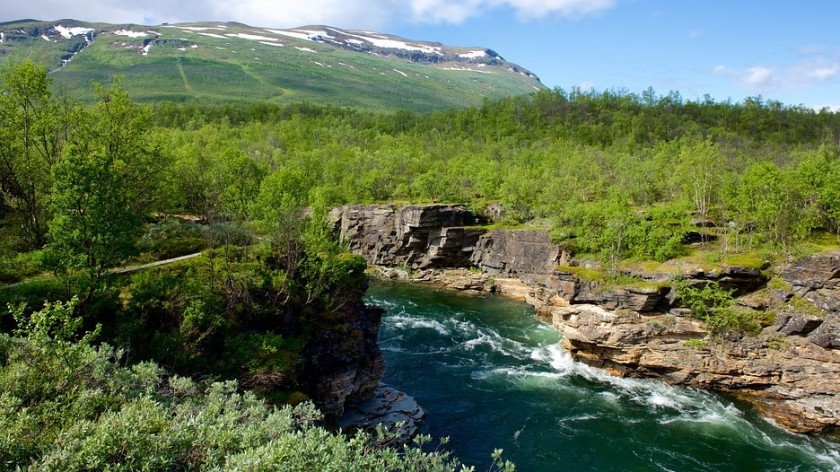
Abisko National Park, Sweden
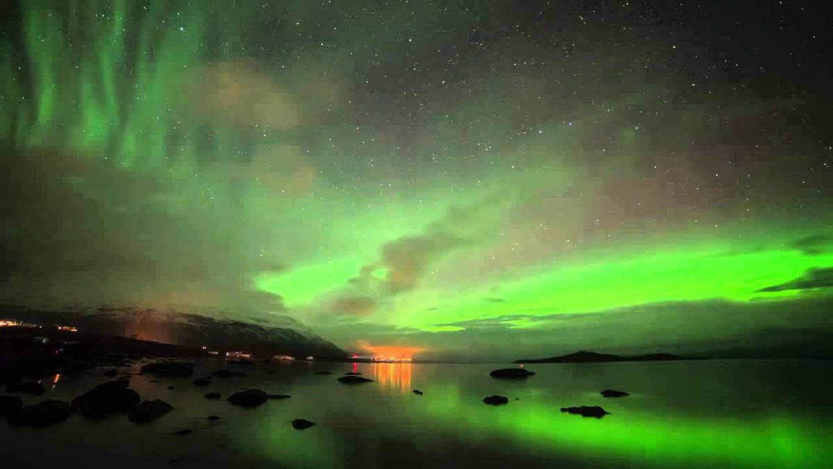
Today I was dreaming of being in Sweden. Not just anywhere in Sweden; I wanted to be under the night sky, looking up at the dark sky viewing the surreal Northern Lights. Fortunetly I was able to work from home today due to the 12 hour day last night to meet an impossible deadline..But I would much rather be staring up at the northern lights without a worry in the world..
One of the most famous locations in Europe to view the Northern Lights is within one of the most beautiful, scenic, & oldest National parks Sweden has to offer. Located on the Northern tip of Sweden, North of the Arctic Circle, and bordering Norway is where Abisko National Park resides. Abisko National Park is known for its extended hiking that extend upwards to 440KM (270miles) long throughout the park.
How to get there: Abisko National Park is located about 100KM (62 Miles) west of the community of Kiruna as well as located about 75KM (46 Miles) from Narvik. Both locations take about 1 hour 10 minutes to get to by either bus, train, or personal vehicle. The National park has a railway station that stops at the Abisko Turist station that runs from both Kiruna & Narvik. If you plan on driving, the European route 10 goes through national park.
When you reach Abisko National Park, you have one of 2 options when it comes to your stay: sleep in the mountain lodge or camp. The mountain lodge there is a hotel standard which includes a restaurant, hostel, cabins as well as a campsite. Personally if this was me I would be parking in my Van-home and camping throughout the hike to get the most experience out of the trip.
The temperature here differs throughout the year. During the summer temperatures can range from 13-17°C (55-62°F) and during winter months the average is around -22 to -3°C (-8-(-27) °F) in the winter.
Wildlife: There is an abundance of bird diversity in this area, so if you are a bird enthusiast, this area will not disappoint as long as you do not come during the dead of winter. When it comes to larger animals, the most common are the marten, staot, Europpean squirrel, moose, and reindeer. The less common but still habitable in the region are wolverines, artic foxes, lynx and bears.
Things to do: In Abisko there is something to do year round. During the summer, kayaking and canoeing in the endless lakes that this park has to offer is extremely popular. Hiking is what brings most of the tourists to this national park when visiting Sweden as it holds the famous Kungsleden hiking trail which is used for dogsled tours in the winter. With that said, dogsledding is extremely popular in Abisko as well as everywhere else in Northern Sweden and is a must do while visiting this area in the winter. There are endless amounts of hiking trails, ranging from mountainous to flat trailed, you will be able to find something to enjoy. When you are here during the winter months, Abisko has a few chairlists for downhill skilling as well as cross-country skiing trails.


The Northern Lights: Year-round this spectacular show of natural lights that our planet has to offer us is known as the Northern Lights. Something I feel that every individual on this planet should not go without seeing at least once in their lifetime, the Northern Lights is what brings so many yearly tourists to this park every year.
Abisko National Park is one that anyone who enjoys hiking and being in a peaceful quiet environment would enjoy the most. This park is surely somewhere I plan on visiting at least once in my life to sleep under the Northern Lights.
Thank you for reading. Please like, share, and subscribe for more daily places in the world that I am currently dreaming of being at rather than work.
Please note: I do not advertise for any of the mentioned companies or locations in which I write about. I do this 100% for fun and for other want-to-be travelers who want to read my posts.
Devil’s Path, New York
Devil’s Path is a difficult hiking trail that is located in the Greene County section of the Catskill Mountains in New York, United States of America. The trail is approximately 24 miles long, elevating upwards of 2,700M(9,000FT) at its highest point along the path. This trail attracts hikers from all over due to the challenging climbs straight up and down steep gaps between different peaks on the mountain range. This trail often requires hikers to use hands as well as their feet to pull themselves almost straight up cliffs and through the rocky shoots. Devil’s Path starts on Platte Clove Road, New York. This road is extremely dangerous during the winter because of the steep and windy roads and can often be closed off. This trail is best hiked between March and October and provides spectacular views year round.

There are a few different ways of going about this trail.
One way is when you make it to Platte Clove Road, you have 2 options: East or West. The Eastern half of the trail is the more treacherous of the two trails, and attracts daring hikers (like myself) from all over the country for a challenging and rewarding hike. The western half has fewer ups and downs, remaining more flat throughout the hike. The mountains come progressively closer throughout the hike, until you reach the tallest point, West Kill. At this point either finish the hike, or head on back.
Another popular that hikers often do, require 2 vehicles or a taxi reservation. Park one vehicle at Devil’s Tombstone Campground, hop in the other vehicle and drive to the entrance on Prediger Road. This path is one of the more popular because although it is 16 miles long, this way can be completed in a single, long day.

If you are interested in backpacking and spending more than 1 day on this trail, repeat the above process of parking 2 vehicles, one at Tombstone Campground and the other on Prediger Road. Complete your hike and stay at the campground for $16. Here you will have access to water, food, have the ability to build a fire, and gain some rest for the next day. The next morning, continue onwards to complete the other half of the trail then head back to the campground to complete your 2-3 day hike.
There are plenty of fresh water springs and rivers throughout this path, so it is recommended to research ahead of time these locations so you are aware of when to stop to refill. Bring a water filter as it is will save you some weight of carrying 2 gallons of water on your back.
You are not allowed to camp or start a fire in any area above 1550M(3500FT) in elevation due to the risk of starting a forest fire. The fines are hefty and you can even spend jail time. There are signs that post these warnings very clearly throughout the trails.

This hike is definitely something that any hiking enthusiast should attempt. It may sound extremely dangerous but as long as you take your time, stay hydrated, and stay aware of your surroundings, you will have no issues completing this trail.. and trust me the view is rewarding. I usually go hike this trail at least once a year as it is the most challenging, rewarding, and enjoyable hike within 3 hours of NYC. Ensure to get an early start… I recommend waking up early and start heading up before dark to guarantee you complete the hike before nightfall. Please use your best judgment as everyone hikes at a different pace.

Fun fact: The naming of this trail is actually pretty interesting. The trail was named The Devil’s Path because the route is so difficult and steep at certain points that it was originally believed that only the Devil could complete this trail because of his hooves. The Devil was believed to have come here to escape, when he had to.

Thank you for reading. Please like, share and subscribe for more daily places in the world that I am currently dreaming of being at rather than work.
Please Note: I do not advertise for any of the mentioned companies or locations in which I advertise for. I do this 100% for fun and for other want-to-be travelers who want to read
Acadia National Park
Acadia National Park is located in the North-Eastern United States of America. The National Park is located on Mount Desert Island, in the US State of Maine, and covers most of the island along with other smaller nearby islands in the Atlantic Ocean. Acadia is one of the oldest national parks in the country, as well as one of the smallest. Covering only 40,000 acres of land, this National Park has the most scenic views per square acre in the entire United States. I had actually visited Acadia last summer. Today while I am 45 stories up in the middle of the concrete jungle, I had a sudden craving for the delicious lobster and immediately wanted to be back in Maine. There are 2 main parts to Acadia, the “Maine” (main) side, which is the Eastern side of the island, and the quiet (western) side of the island. The Eastern side is home to the most famous trails including the beech trail, beehive trail, precipice trail, thunder hole, and more. The quiet side has much to offer as well, and I highly recommend spending at least a day there from my experiences.

Climate in Acadia: Because of Acadia’s geographical location, it has 4 very distinct seasons. Spring and Fall can range anywhere from 30-70 degrees Fahrenheit, while the summer can average anywhere from 45-90 degrees Fahrenheit. The winter can be brutal: temperatures average from below zero-mid 30’s in Fahrenheit. Snowfall in the winter is only 61 inches on average, but is a beautiful sight if you ever get the chance. When I was here, it was during the month of August and temperatures were in the mid 80’s all week long, and dropped to almost 40 degrees Fahrenheit every night.
Wildlife in Acadia: Acadia is home to about 40 different species of mammals including squirrels, chipmunks (so many chipmunks..), white-tailed deer, moose (don’t count on seeing any here), beavers, porcupines, minks, muskrats, fox, raccoons, coyotes, bobcats, black bears (rare), falcons, golden eagles, owls, hawks and bald eagles. You may also get to see seals, dolphins, and humpback whales if you make your way onto a tour boat. If you are a bird-watching enthusiast, then Acadia could be a good fit for you. I did not see a ton of birds, but there was at least 10 different species of birds that I ran into in just 4 days. I just want to cover moose in Acadia real quick. The reason why Acadia adds Moose into their list is because Moose used to migrate through the park. They are rarely seen anymore due to the high human population around the entrance to the park. If you want to see Moose you need to drive approximately 2 hours North-West to Kennebec County, also known as Moose County. This national park is less about the wildlife, and more about the scenic views and epic hiking trails the park has to offer.
How to get there: The closest airport is located in Bangor, Maine, however the flights there are very infrequent depending on where you are coming from. Your best bet is to fly into Portland, Maine. From either of these airports rent a car and drive. If you are driving to Maine, use an updated GPS or Google Maps to get you to Acadia as the United States has practically every road mapped out through GPS. 
Where to stay: If you are making the trip to Acadia, to get the most out of the park, I recommend camping. There are numerous campsites that are fairly cheap (Mine cost $20USD / Day), and they all include showers, electricity, as well as a little shop for basic needs. If you do not want to camp, there are plenty of hotels and Bed & Breakfast locations in Bar Harbor, which is located on the North-Eastern side of the island.
Things to do in Acadia:
Bar Harbor is a must while you are visiting. It is a small old-style fishing town that has a ton of shops, restaurants, nature tours, whale watching tours, & LOBSTER. While you are here, you must get Lobster. If you do not get lobster then you did not really go to Acadia. My favorite place for lobster was Geddy’s. Geddy’s prepares and pre-cuts the lobster for you. They have the best lunch specials which included corn on the cob, clam chowder, a drink, a blueberry pie slice, and a 1 ¼ lb lobster for $20. The other restaurants, including the famous Stewman’s Lobster Pound, are over-rated and consist of foreigner workers who can barely speak English and always messed up our orders.

Hiking: Hiking in Acadia is one of the Maine(main) attractions. Hiking here is difficult yet extremely rewarding. The most famous trail is the beech trail, which is an easy hiking trail that is popular among families with younger children. This trail provides a scenic view of the Ocean and is a few miles long. If you are looking for a truly challenging experience check out the beech cliffs trail, beehive trail, and the precipice trail. These trails are all considered a ladder and railing trail. They are difficult and only attempt when the rocks are dry. I completed all of these trails, and I loved them. The views at the top are amazing, and you really have to earn it. One of my favorite hikes was the Jorden Pond to the Bubble trail. This trail starts at Jorden Pond, continues into the Bubble trails. From there you can take the Jorden Cliffs trail which is an extremely difficult trail that really should have railings… This will loop you around back to the parking lot in which you began.
Bike riding: There is one road that connects most of Acadia national park called Park Loop Road. It is a must do if you are big into bike riding. This road is extremely scenic, challenging in some areas, and relaxing in others. The road is 27 miles long.


Other things to do: In Acadia, you can go whale watching, seal watching, dolphin searching, canoeing, kayaking, camping, go out to eat, shopping at the local shops, beer tastings, wine tastings, parasailing, bird-watching, go visit the famous lighthouse, photography, watch the sunrise / sunset, and the famous morning fog depending on the day. One last thing I recommend doing is star gazing along the Beech trail at night. The park is open until midnight so this is a must do.
My recommendation: For visiting Acadia, you can easily get everything done in 4 days. I recommend camping while you are here for the full experience. Spend 1 day hiking the quiet side of the island, spend 2 days hiking the Maine(main) side of the island, spend 1 day doing anything else you choose. Spend 2 nights going into Bar Harbor (first night is recommended for 1 of 2 nights), spend 1 night star-gazing, and spend the last night just having a nice campfire with some campfire food and beer. Make sure you grab one of the Lobster lunch specials while you are here, especially if you are coming with a family this will save you a lot of money.

Thank you for reading. Please like, share and subscribe for more daily places in the world that I am currently dreaming of being at rather than work.
Please Note: I do not advertise for any of the mentioned companies or locations in which I advertise for. I do this 100% for fun and for other want-to-be travelers who want to read.
